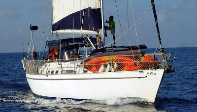
 My father taught me to sail when I was about 8 years old - he's the worried one in the old photo at right (probably because my brother Peter is on mainsheet). With great and delightful understatement, he always said that "a collision at sea can ruin your whole day". He's absolutely right of course, though nowadays we can use AIS technology to help avoid those "ruined days". This is the first of three posts regarding the system, and basically describes the technology. Future posts will cover our installation experiences and the system in operation.
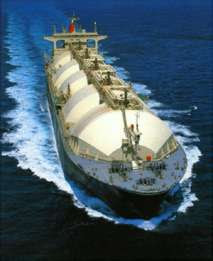 Some years ago the International Maritime Organisation (IMO) ratified a standard requiring all ships over 300 tons to carry an Automatic Identification System (AIS) transponder. This was a major step forward in collision avoidance for ships at sea. The system really works - AIS equipped ships constantly transmit information including name, MMSI number, position, speed, course, rate of turn, cargo carried etc etc. Commercial vessels within range receive that data, which is then displayed on dedicated screens or (in most cases) overlaid onto radar or chart plotting screens. The result is that AIS equipped vessels are readily identified, tracked and avoided.
This is a significant primary safety system, and many in the yachting community have taken advantage by purchasing low cost AIS receivers - these display ship locations on navigation chart plotters, or on suitably equiped navigation computers. Whilst an AIS receiver system is a good thing to have, I always believed that the best safety system required the big ships to see me as well - I wanted a transponder that would transmit and receive.
Nowadays we can all see and be seen, with low cost AIS transponders available to the cruising and pleasure craft community. The "big ship" Class A systems are expensive, so the IMO has also ratified a simpler version called AIS Class B, for pleasure vessels.
There are important differences between the two, however they are designed to work together. Class A systems use dedicated GPS receivers for position information and system timing. They then transmit a wide range of vessel data, and do so quite frequently, using coded data bursts on VHF channels 87 & 88. The system uses a protocol called SOTDMA to keep everything organised, with GPS derived time managing the broadcast slots. With 2250 time slots on each
 channel every second, the dual channel system provides up to 4500 time slots. Class A systems transmit at up to 12.5 watts. A ship travelling at more than 14 knots will transmit dynamic data every 6 seconds. A course change increases the burst rate to every 2 seconds.
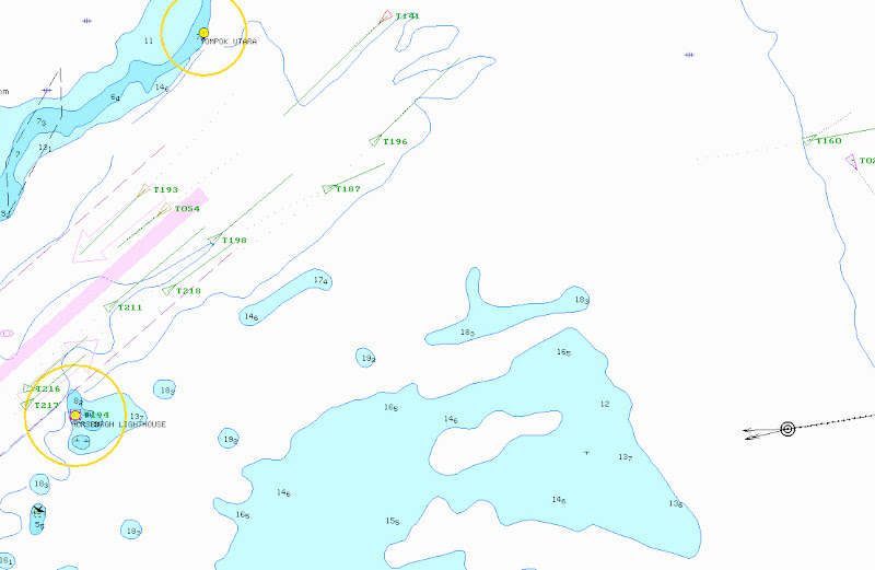
Thats us in the chart plotter image at right, the black circle and arrows on the lower right, moving west. At left of the image are AIS equipped ships entering and exiting Singapore Straits, into the Sth. China Sea. Click the image to enlarge.
Class B systems also use a dedicated GPS receiver, but transmit a more restricted data set (no rate of turn, destination, ETA or cargo information) and do so less frequently, using less power (maximum 2 watts). The control protocol is CSTDMA (Carrier Sense Time Division Multiple Access). Basically the Class B systems listen for a gap in the Class A traffic, then transmit. There is no guarantee that any individual data burst will be successfull, however the system transmits a burst every 30 seconds when underway. Even in Singapore, with literally hundreds of ships transmitting close by, I've watched very solid returns from Class B equipped vessels in the Singapore Straits. The system can certainly process lots of traffic - our transponder identified over 1000 targets (!) in 48 hours on our recent passage from Singapore to Langkawi.
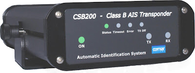 Most of the approved Class B systems use a common internal circuit board, made by Software Radio Technology (SRT) in the UK. SRT was part of the IMO advisory panel that set the standard, so its no surprise they have complying product on the market. Our Comar CSB200 AIS transponder (user manual here) uses the SRT circuit board.
AIS is already compulsory on pleasure craft in some parts of the world (eg South Korea), and I believe it will become mandatory in many countries. In Singapore, pleasure craft must carry either an AIS-B transponder or one of the local HARTS transponders that use cellphone technology as the data link to shore based monitoring stations (more info on HARTS is here - thanks to Terry Sargent on SV Valhalla for the document).
For more background information on the politics, technology and products behind AIS, I suggest you spend awhile reading the AIS links on the excellent PANBO blogsite here. A very good background story, published by Yachting World, is also available here. Our own installation experiences will be posted next.


